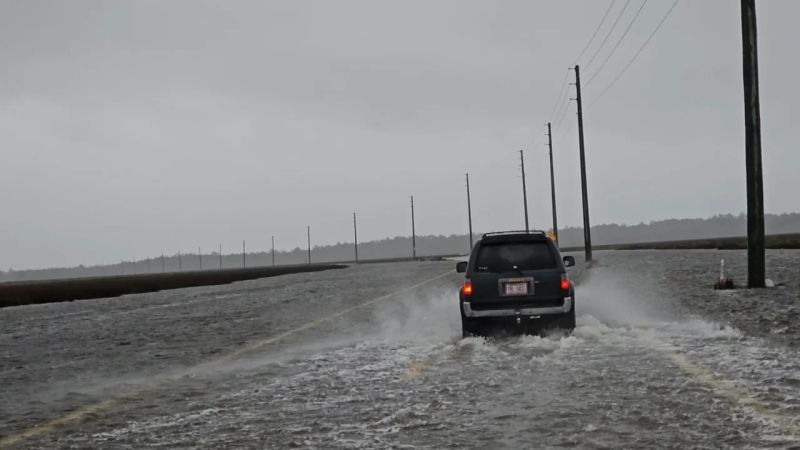
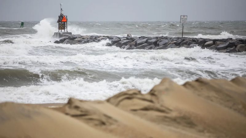
Tropical Storm Ophelia is lashing parts of the East Coast with powerful winds and heavy rain ahead of its expected landfall early Saturday along North Carolina’s coast, where the threat of storm surge and dangerous flash floo

Tropical Storm Ophelia is lashing parts of the East Coast with powerful winds and heavy rain ahead of its expected landfall early Saturday along North Carolina’s coast, where the threat of storm surge and dangerous flash flooding looms.
The storm is expected to bring heavy rain across a large swath of the mid-Atlantic, from as far south as North Carolina and Virginia to Delaware and New York beginning early Saturday and continuing through the weekend.
Read also: Top 10 Best Football Clubs In Morrocco
But coastal areas in North Carolina are expected to bear the brunt of impacts as the expansive storm is poised to make landfall early Saturday, the National Hurricane Center said.

Ophelia, which packs tropical-storm-force winds that extend more than 300 miles, is on track to move across eastern North Carolina and then travel through southeastern Virginia, before heading further north the Delmarva Peninsula Saturday and Sunday, the hurricane center said.
Read also: Top 10 Best Football Clubs In Guinea
Key threats:
- Hurricane watch: Areas north of Surf City, North Carolina, to Ocracoke Inlet are under a hurricane watch. The state is also under an emergency declaration.
- Storm surge threat: Storm surge watches and warnings are in effect from Surf City, North Carolina, to the Chesapeake Bay. A storm surge happens when strong winds cause water levels to rise and push water on-shore. Water levels began rising Friday night along some coastal areas in North Carolina.
- Dangerous flooding: Risk of flash flooding during overnight hours has increased for eastern North Carolina, according to the state’s emergency management department. Storm surge is forecast along the Pamlico and Neuse Rivers, the department warned.
As of late Friday, Ophelia’s maximum sustained winds were measured at 70 mph with higher gusts. The storm was located 70 miles south of Cape Lookout, North Carolina, the hurricane center said at 11 p.m. ET. Moving at about 12 mph, Ophelia is expected to trek north along the East Coast over the weekend after its expected weakening.
In anticipation of that, a hurricane watch was issued for parts of eastern North Carolina, where water levels were already rising along some coastal areas Friday night and a state of emergency is in effect.
Storm surge watches and warnings are in also in effect from coastal North Carolina to the Chesapeake Bay.
“The combination of a dangerous storm surge and the tide will cause normally dry areas near the coast to be flooded by rising waters moving inland from the shoreline,” the hurricane center warned.
Additionally, the threat of flash flooding has increased for eastern North Carolina during the overnight hours into Saturday, according to the state’s emergency management department. Storm surge is forecast along the Pamlico and Neuse Rivers, the department warned.
Read also: Top 10 Football Clubs In Cameroon
The storm’s strong winds could also knock out power in some places, particularly along the coast. As the storm threatens to bombard coastal areas with the worst of the winds and rain, some inland communities in southern New England will still see impacts.
Tropical-storm-force winds – between 39 and 73 mph – extend outward up to 310 miles from the Ophelia’s center, according to the hurricane center.

Read also: Top 10 Football Clubs In Sierra Leone
“Heavy rainfall from this system could produce locally considerable flash, and urban flooding impacts across portions of the Mid-Atlantic states from North Carolina to New Jersey through Sunday,” the hurricane center said.
The storm could also bring dangerous surf and rip currents along East Coast through the weekend, the hurricane center warned.
One to 5 feet of surge is possible in some areas, particularly in inlets and rivers from around Surf City, North Carolina, to Manasquan Inlet on the New Jersey shore.

